


 The most famous arch in all of Arches is the "Delicate Arch." This one is in the brochure and pictures and movies and things. We hiked up the trail to take a peek...
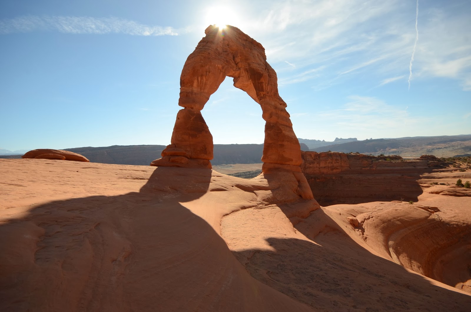
From a certain angle it looks almost like a pair of legs, standing strong against the forces of erosion.


 Before we left the area we had to check out Canyonlands National Park, which is a place I have to return to. It is grand, for sure, though not the Grand Canyon. The Green River and the Colorado (funny, that the green (verde) and the colorado (color rado = color red) meet here. I wonder about the names, and who named them.) meet here and they form great big depressions in the high country. We camped at 6,000 ft and could have easily jumped down to 2,000 or so just by going a little bit to the side.

 We left Arches and passed out of the town of Moab and into the deserted reaches of southern Utah. We puttered through Natural Bridges National Monument, which was a neat place with a twisty canyon through sandstone, and in some of the places where the twists and turns of the river went too far, the twist came back to bite it. Up high, the river turns in a wide turn and a peninsula is born, but then later on, as the canyon is deeper, the turn extends under more and more, until a bridge is formed. I learned that this is much different than an arch, which is a more common formation (I guess 2000 arches in Arches National Park), and consequently there are very few Natural Bridges in the world. There were three in this park and that is the most in a close proximity in the world.
 Arches are formed (as I understand it) by the sandstone layers being turned up sideways and then the freezing and thawing and wind erosion carves the bottoms out. I didn't learn this from the ranger, but I conjecture that the water doesn't erode the top because the sandstone is permeable enough to allow the water to seep down, so the top is dried out by the time it gets to freezy time, but the bottom is not. The sides then, would fracture and slowly ablate off, leaving fantastically balanced rocks on small pinnacles and arches. Thus far, it is my favorite.
We took a westbound small scenic road from Blanding towards Lake Powell, and ended up camping in a pastureland spot in a broad valley overlooked by red cliffs and mesas. The sun set with a burning paintbrush, touching the clouds as if it were the last time it would see the sky, and today it was hidden from the clouds. We awoke before the sun to a smooth layer of grey skies, and set off towards Capitol Reef and Bryce Canyon. Both of them have been pretty, but on account of the cloud cover (and the gentle dusting of snow at Bryce), we have elected to go onwards toward Zion. Bryce canyon is at 8300 ft, and on route we passed over a 9600 ft tall pass, the highest yet for the Cheetah.
There is so much to see in this area, and because much of it is so high up, I want to come back in a more summertime kind of season to soak up the sights again. There are also a lot of places I'd like to go visit, given the time, including Four Corners, Mesa Verde, Valley of the Giants, and Meteor Crater. They are close, but not close enough to warrant the trip.
We're starting our return trip now, having passed the furthest point, and have Zion, Las Vegas, Death Valley, and the West Coast to do still. Many miles, but the Cheetah is equal or greater than the task, I think.
 I've been cooking with my little fire breathing stove, so I figured I'd get a few shots of the hullabaloo.
No comments:
Post a Comment